Paperphyte/Drone photography/Drone photography for estate agents

Drone photography for estate agents

Aerial photos and video that show what ground-level shots cannot: plot, location and surroundings. Houses, holiday homes and land near Stockholm and Trosa.

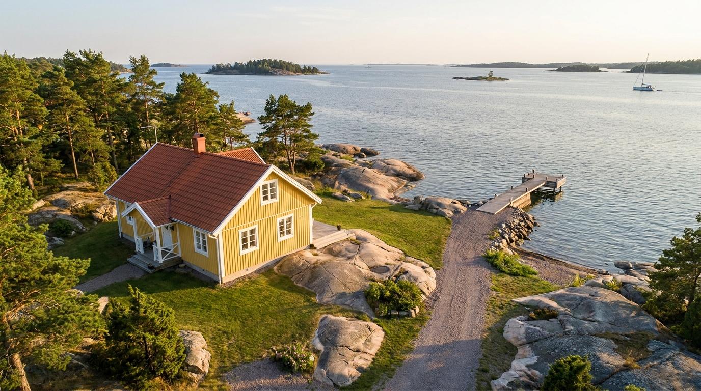
Flygbild i kvällsljus av ett gult trähus med rött tegeltak på en skärgårdstomt med klipphällar och tallar, en grusgång ner till en träbrygga och öppet vatten med små öar

Most listings look the same in the feed: a façade, a kitchen, a living room. The aerial shot answers what the buyer is actually wondering — where is this, and what do I get around it? The shape of the plot, the distance to the neighbour, the path down to the water and the forest behind the house, all in one image.

This page is for estate agents who want to know when drone photography is worth ordering, which images earn their place in the listing and how a job runs. We do not replace your property photographer. We take the pictures that require the camera to leave the ground.
When the aerial shot makes a difference — and when it does not

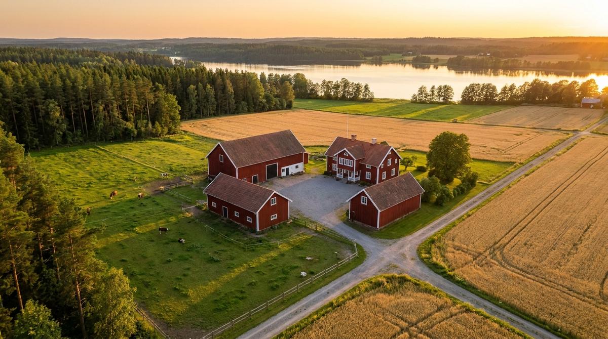
Flygbild i kvällsljus av en gård med rött boningshus, ladugård och uthus kring en grusplan, omgiven av beteshagar och sädesfält, med skog och en sjö i bakgrunden
  • A large or irregular plot. From the ground you cannot show where the plot begins and ends. From the air the whole area is visible, and the boundary can be marked in the image.
  • A location near water, forest or open land. “300 metres to the beach” only becomes credible when the way there is visible.
  • Holiday homes and farms. Here the buyer is paying for the surroundings as much as the house: the jetty, the outbuildings, the pasture, the distance to the nearest neighbour.
  • Undeveloped land. A plot has no façade to photograph. The aerial shot is often the only image that says anything.
  • New builds. Before the building is finished, an aerial image can show the site and the view from the height where the balcony will be.

The drone adds least for a flat in an enclosed city block. The roof tells the buyer nothing, and in the inner city the airspace rules also set tight limits on where and how high you may fly. There the ground-level photos are usually enough. We will say so if we think you can manage without us.

The images worth ordering

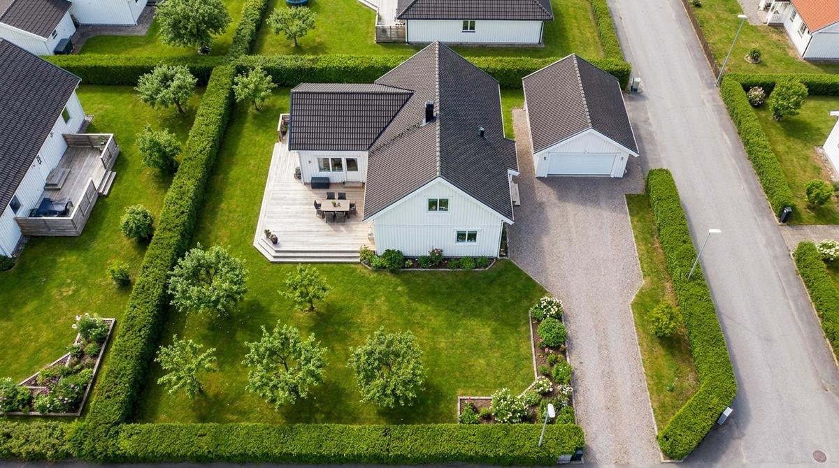
Flygbild högt ovanifrån av en villatomt: vitt hus med mörkt tak, trädäck med utemöbler, garage och grusad infart, gräsmatta med frukträd och häckar som visar tomtens gränser

Different heights do different jobs, and a good order usually includes something from each.

  • Low, at an angle from the front. Just above the treetops, with the house in the foreground and the surroundings behind. The image that works first in the listing: it looks like an ordinary photo but shows more.
  • Mid height. The whole plot with driveway, outbuildings and nearest neighbours. This is where you see how the house sits on the plot and which way the terrace faces.
  • High. The location in the landscape: the distance to the lake, the sea, the town centre or the main road. An image for someone who does not know the area.
  • Straight down. The basis for marking the plot boundary. The marking is an illustration that helps the buyer get their bearings — it does not replace the cadastral map.
  • Short film. A slow approach or a circuit around the house, cut in landscape for the listing page and in portrait for social media.

Light, season and weather

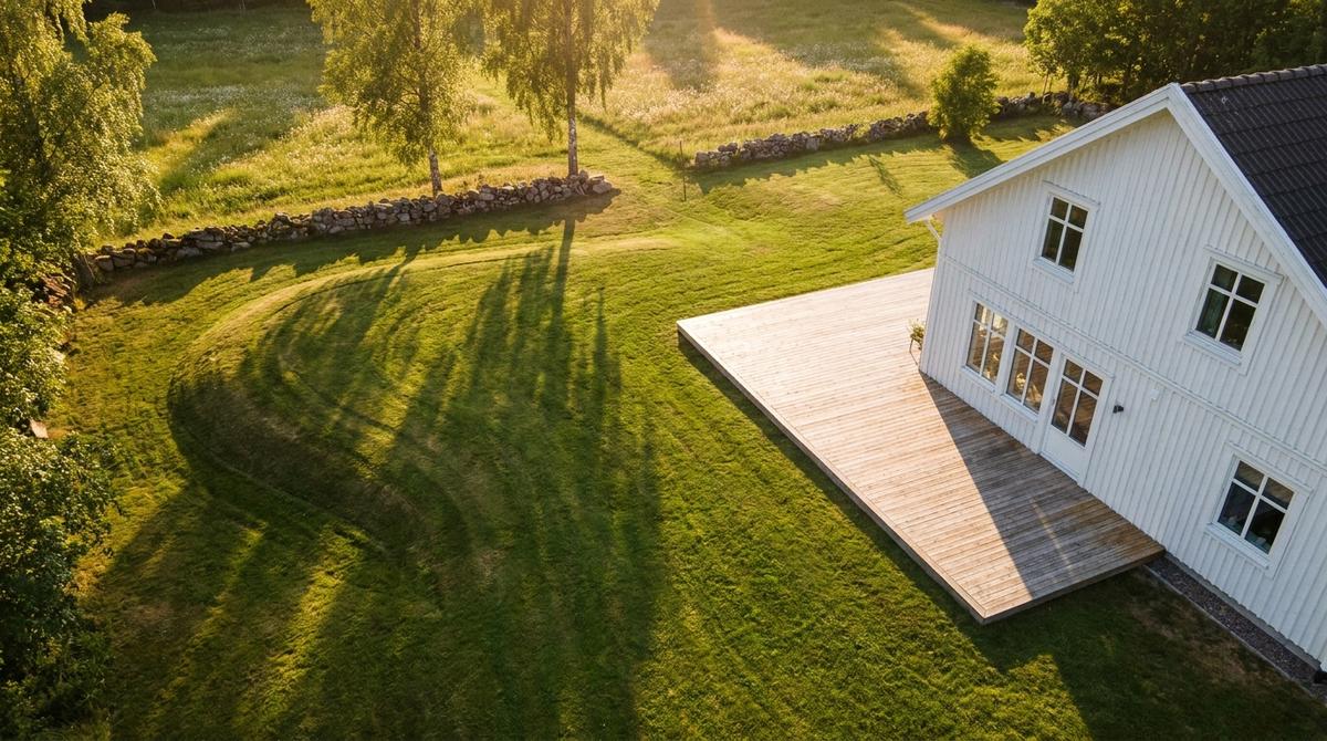
Flygbild i lågt kvällsljus av en vit trävilla med stort trädäck, där björkarnas långa skuggor faller över gräsmattan framför en stenmur och en äng

Light matters more in an aerial image than in an interior. At midday roofs and lawns go flat; early morning and late afternoon give shadows that show the terrain and a warmer light on the façade. We look at how the house is oriented and suggest a time accordingly — a west-facing deck should be photographed when the sun is actually on it.

The season shows more clearly from the air than from the ground. Summer greenery looks best, but bare ground works well and shows the plot honestly. Snow hides boundaries, paths and flower beds. If the property goes to market in February it can still be photographed, as long as you know what the image will show.

Weather cannot be ordered. Rain and strong wind cancel a flight, which is why it is wise to book the drone shoot a few days before the regular photo day rather than the same morning the listing goes live.

Preparing the property

From the air you see things nobody thinks about from the ground. Ask the seller for four things before the flight:

  • Cars off the driveway and off the street in front of the house.
  • Bins, trampolines and tarpaulins out of sight — anything loose and brightly coloured.
  • The lawn mown and the leaves raked.
  • Garden furniture and parasols in place, so the terrace reads as a terrace.

We do not photograph people, and we frame out the neighbours’ terraces. If a person or a number plate can still be recognised in an image, we crop or retouch before delivery.

How to order

Send the address, the photo day or viewing date, and what the images should bring out — the plot, the lakeside location, the view. We check the airspace at the address: near airports and in certain protected areas a permit is required or the height is limited, and you want to know that before you promise the seller anything.

Then we propose a time based on light and weather. The flight itself is short. You get stills and video edited in formats for the listing page, the ad and social media.

Get in touch with the address and we reply within 48 hours.

01 / 04

Discover

We learn the business, map stakeholders and identify where the real value actually lives.

02 / 04

Define

Concrete scope, decision points and a plan you can take to the board.

03 / 04

Build

Short sprints, continuous demo, incremental release. No 6-month waterfalls.

04 / 04

Operate

We help hand it back to your team, or stay on as a managed-operations partner.

Got a problem worth solving?

Contact us →